STRATA
Sports-Anchored Mixed-Use District · Doraville, Georgia · Auburn University
Project overview
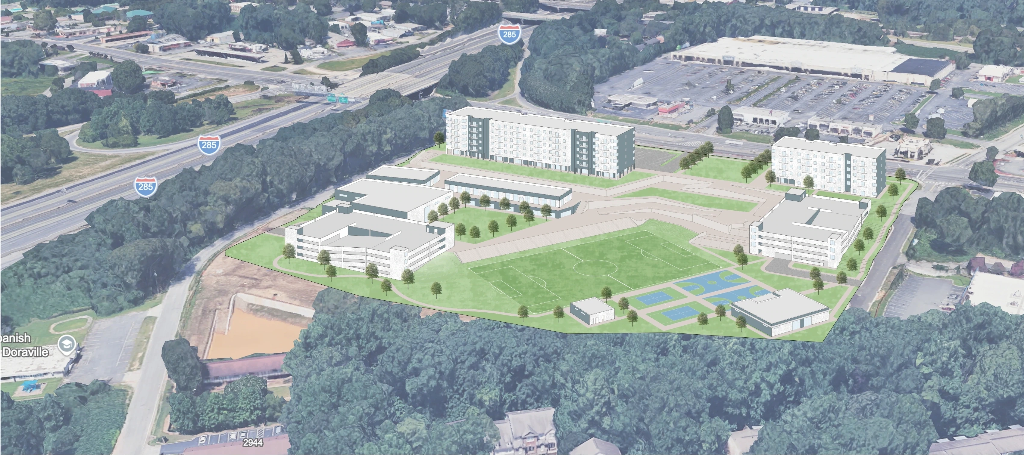
STRATA is a proposal for a sports-anchored mixed-use district along Buford Highway in Doraville, Georgia. The design brings housing, retail, fitness, and recreation together around a pedestrian spine that connects the street to the athletic fields. Rather than flattening the site, the project uses its approximately 30-foot change in elevation to organize programs across multiple levels.
Street-facing retail and housing occupy the upper portions of the site, while indoor recreation, courts, and fields connect through intermediate terraces and accessible circulation. Structured parking reduces the amount of surface area dedicated to cars, creating more room for public activity.
Project details
- Project
- Bachelor of Architecture Thesis, 2026
- University
- Auburn University
- Location
- 5597 Buford Highway, Doraville, Georgia
- Site
- Approximately 13 acres
- Program
- 118 residential units; 17 retail shops; fitness and outdoor recreation
- Parking
- 546 spaces across structured and surface parking
- Focus
- Topography, pedestrian circulation, program layering, and public space
Site organization
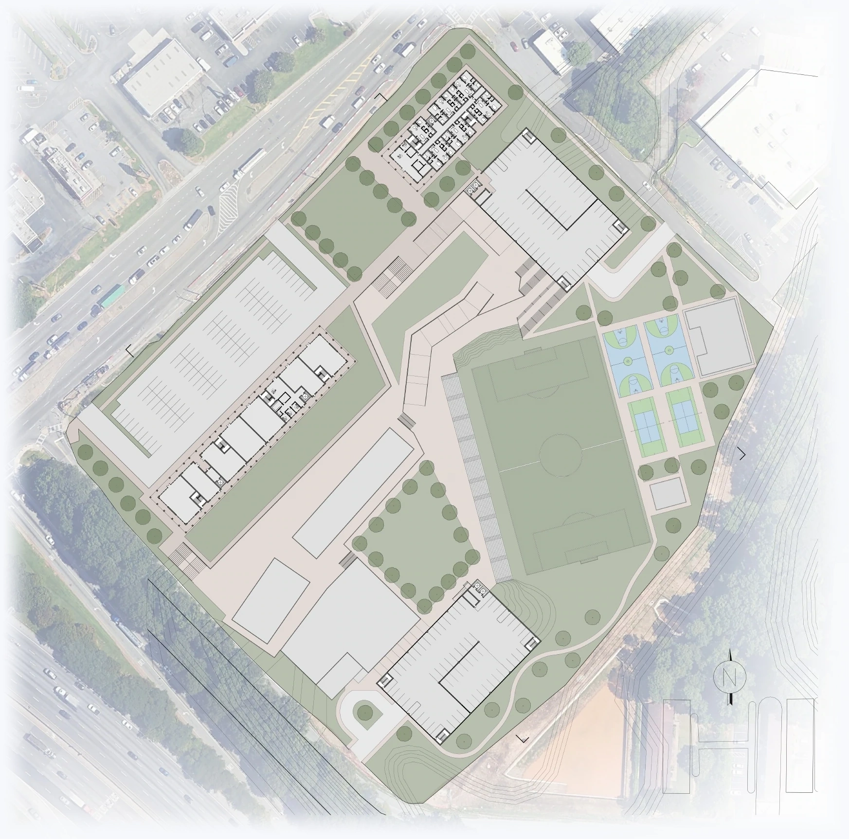
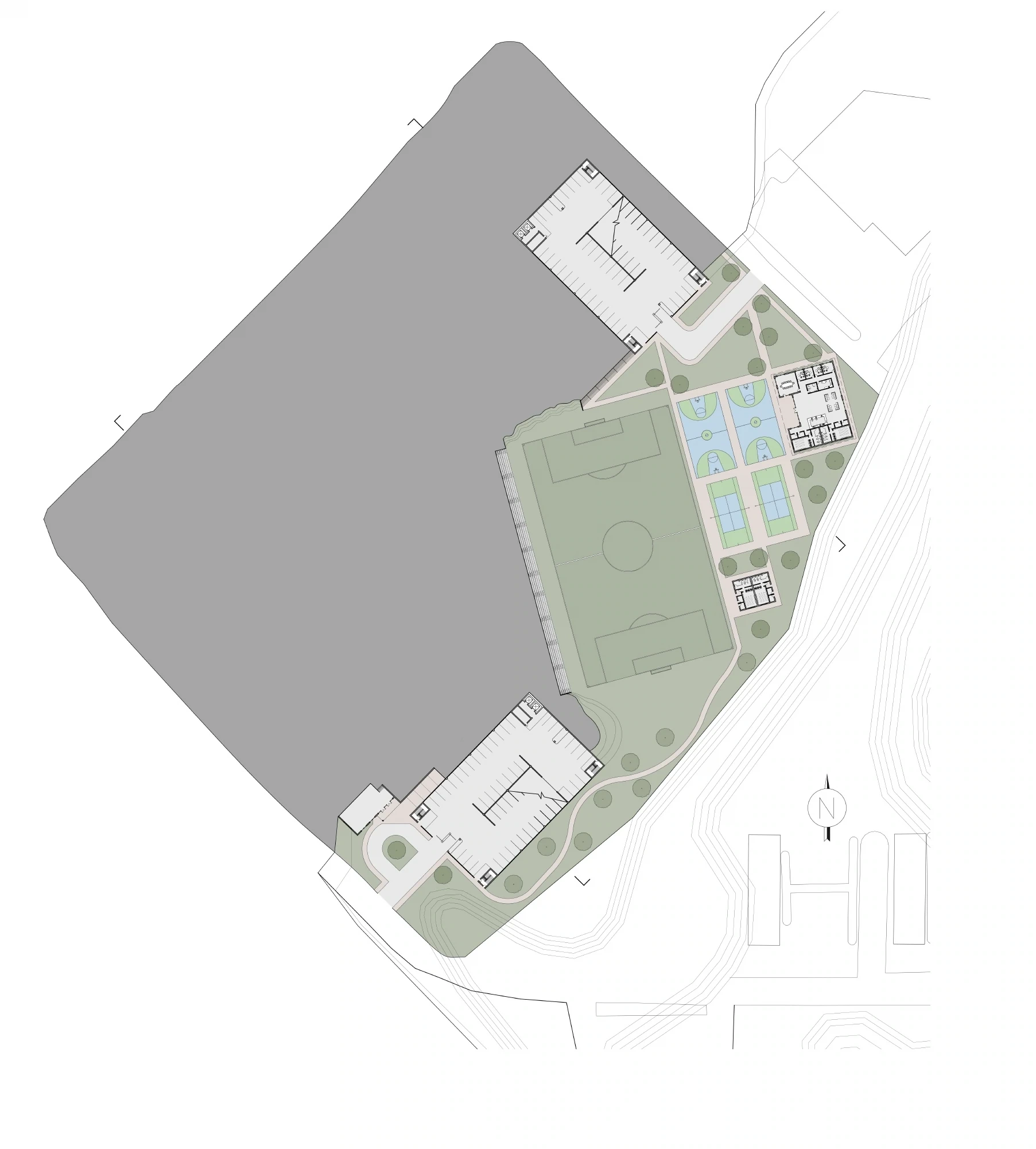
The master plan arranges retail and residential buildings above a central recreation precinct, with paths and terraces connecting the development through the slope.
Four connected levels
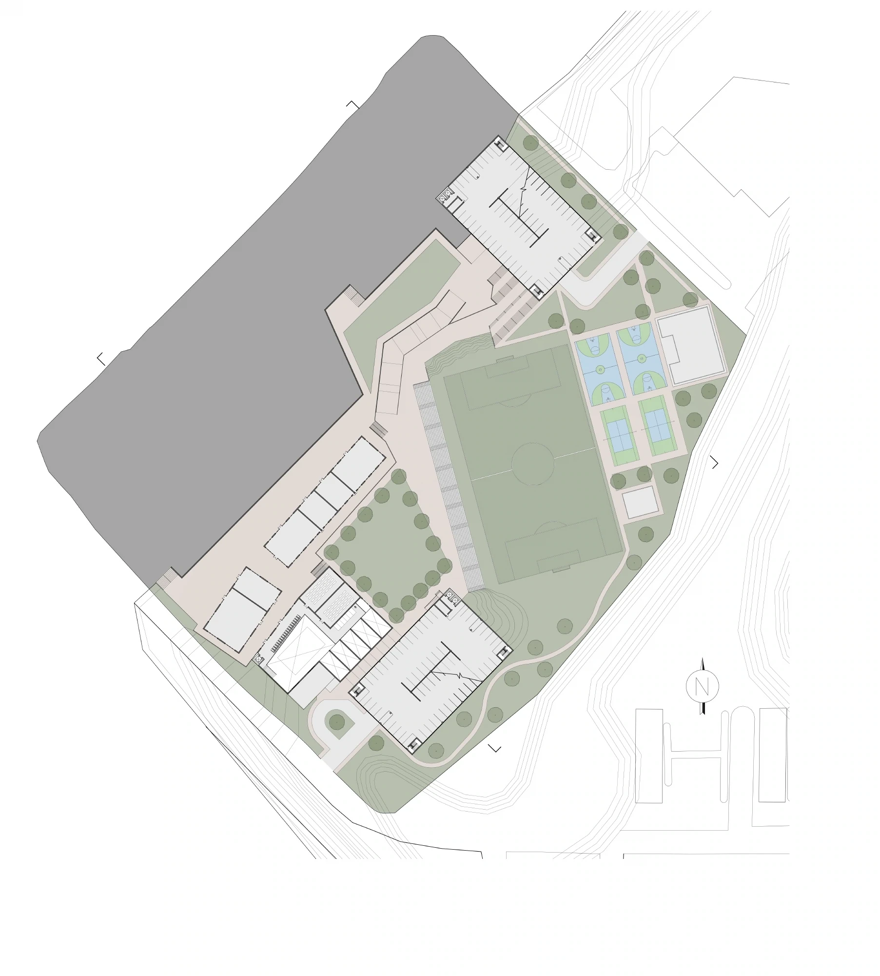
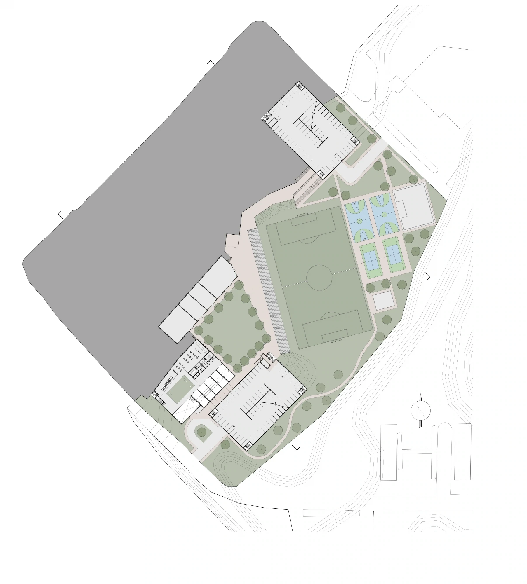
The complete sequence of four site plans shows how the development steps from street level at 0′ down to the athletic fields at −30′. The street-level plan also appears enlarged above for closer review.
Buildings and public space
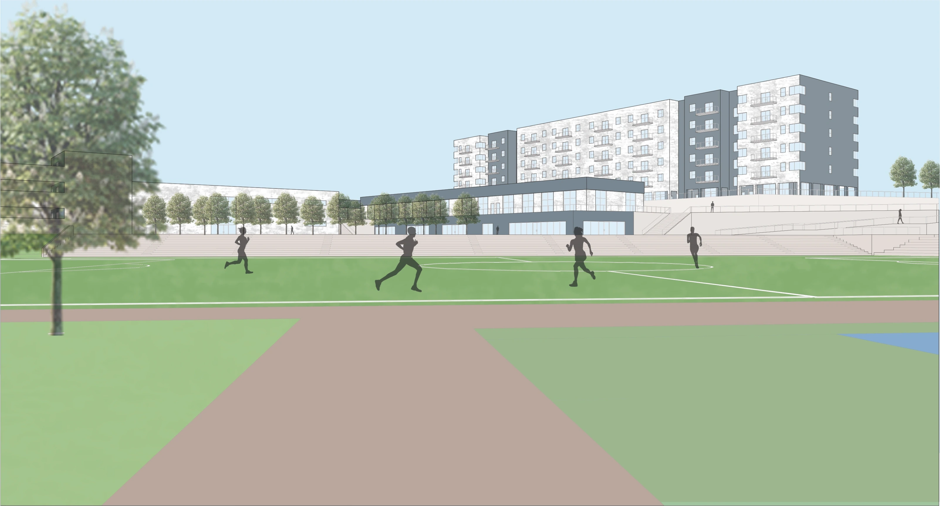
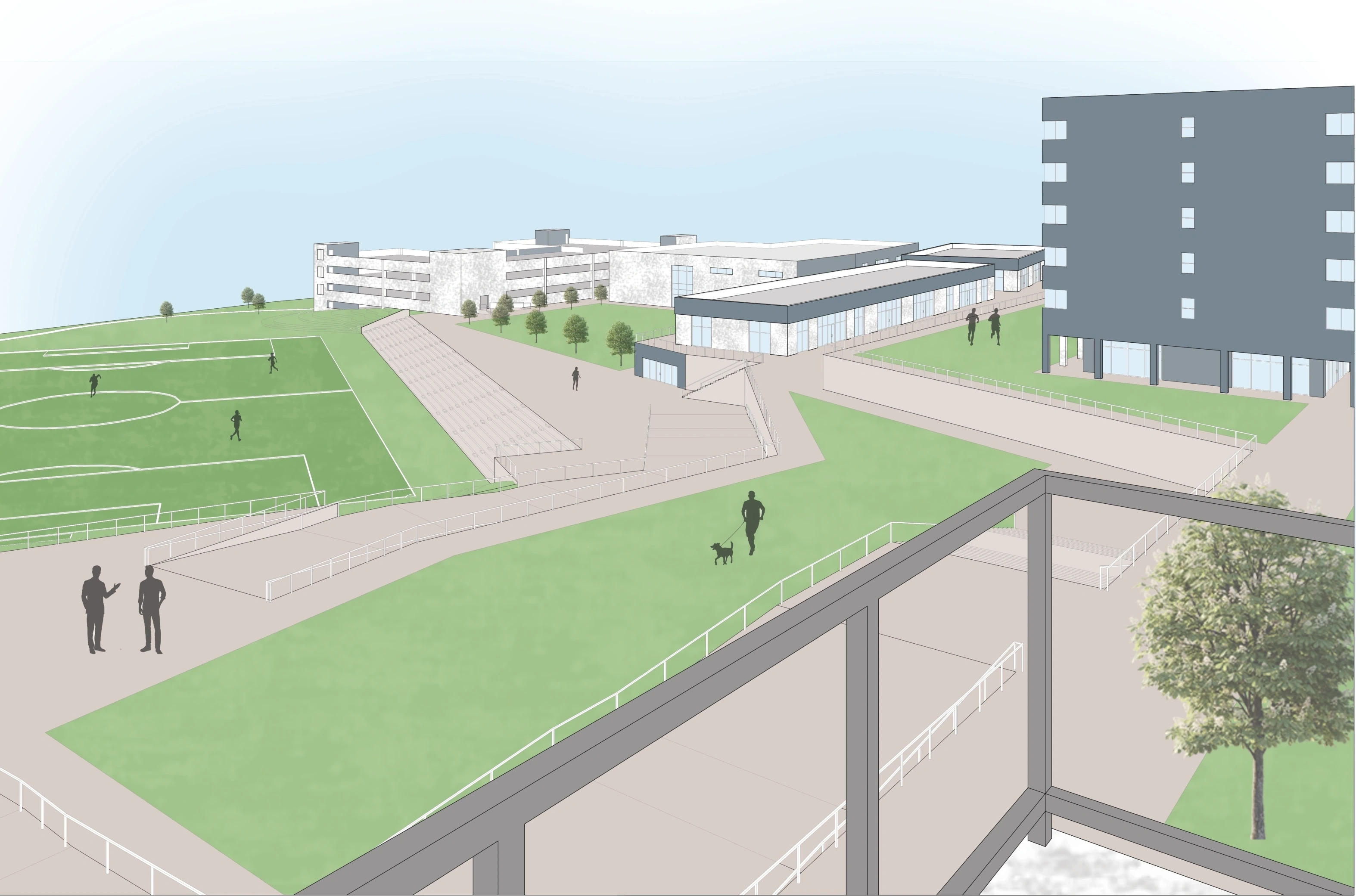
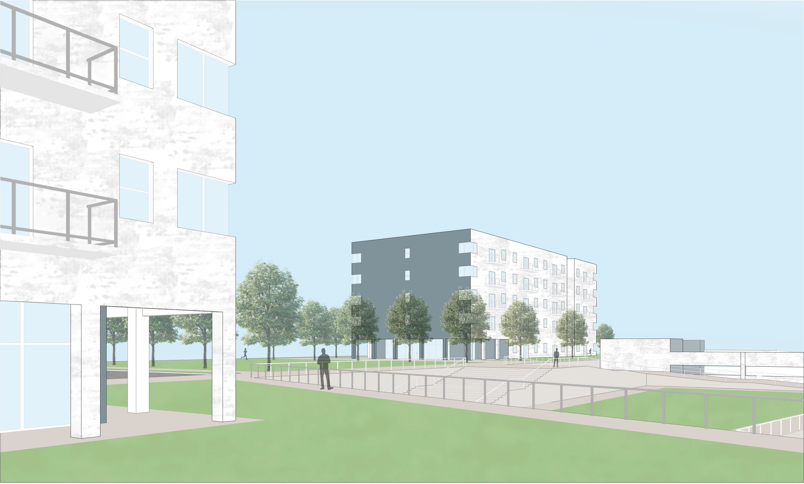
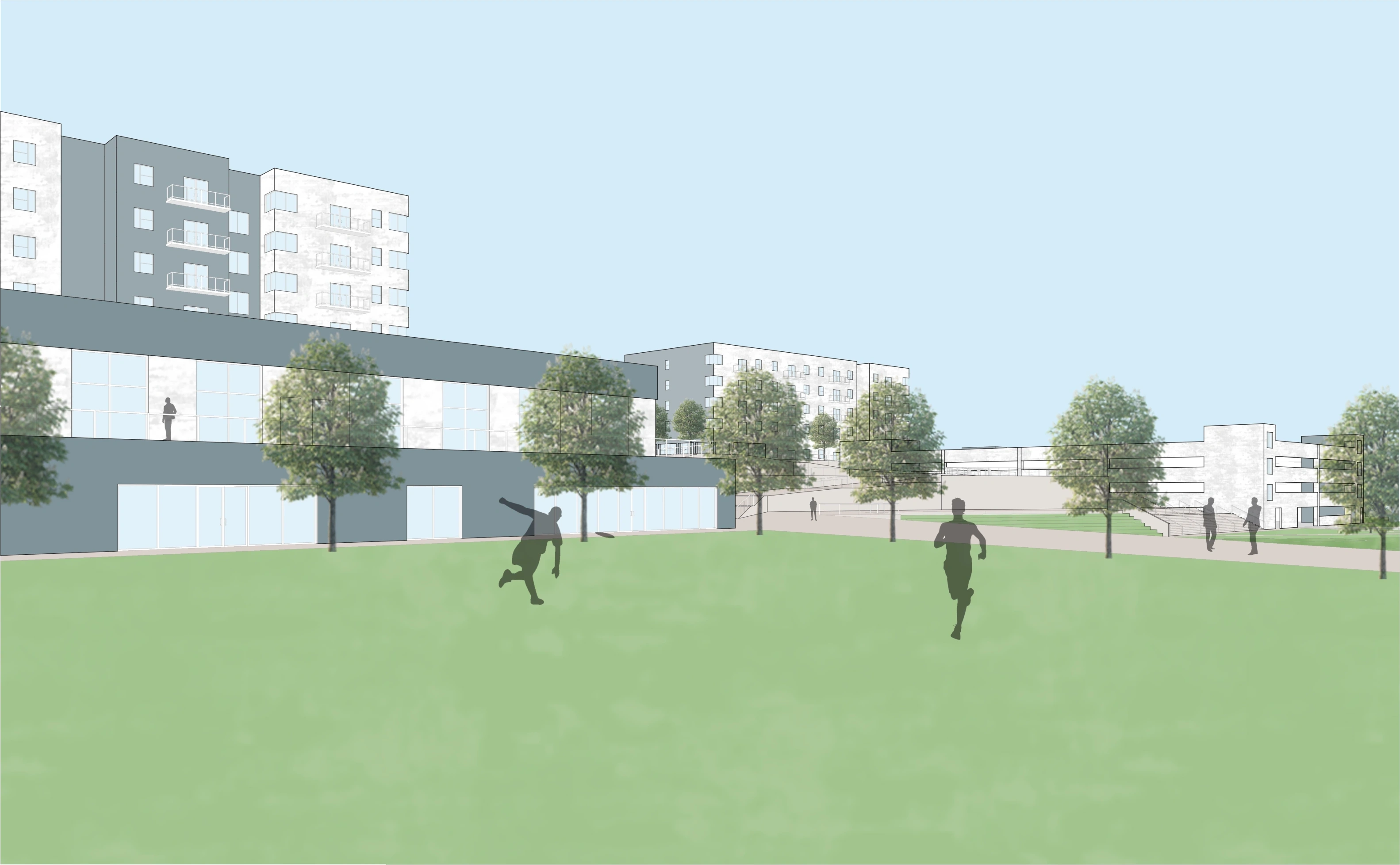
Views of the athletic fields, pedestrian connections, and residential edges show how recreation shapes everyday circulation through the district.
Program across the grade
The long section shows how housing, recreation, and parking occupy different elevations while remaining part of one connected development.

View the complete 2026 STRATA thesis book, including site research, precedents, drawings, and project conclusions.